

Civil 3D alternatives for survey work: an honest look
· 9 min read · by the Backsight team
Civil 3D is the industry standard for a reason: it is the most complete civil design environment ever built, it speaks DWG natively, and two decades of DOT templates, firm standards and muscle memory live inside it. If your work is corridor design, pressure networks, or grading plans that ship to a consultant who marks them up in the same file, this article will not talk you out of it, and should not.
But a lot of survey firms run Civil 3D the way most people run a spreadsheet: a fraction of the surface area, at the full price. If your seats spend their days importing points, drafting figures, building surfaces, running volumes and issuing plans, and the corridor tools have never been opened, you are paying a few thousand dollars per seat, per year, for drafting and COGO. That is the case for looking around.
What actually matters when you switch
Before any product names, the checklist. A survey alternative earns its place only if it covers these without asterisks:
- Interchange you can trust. Your history is in DWG, and your clients will keep asking for it. At minimum you need clean DXF and LandXML in both directions, geometry, layers, surfaces and alignments surviving the trip.
- Real coordinate-system handling. In Canada that means NAD83 Original and NAD83(CSRS) treated as different systems, proper 3TM/MTM/UTM zones, and orthometric heights only through a geoid model, not a “close enough” button.
- The whole survey chain, not just CAD. Points with description keys and figure coding, surfaces with honest volumes, and, increasingly, drone and LiDAR data without a second subscription.
- Deliverables. Plot sheets with your title block, exports your clients open, reports you can stand behind.
The alternatives, honestly
Carlson Survey / Carlson Civil
The traditional answer for survey firms leaving Autodesk. Carlson has deep survey roots, field-to-finish, COGO and surfaces are first-class, it runs on IntelliCAD or on top of AutoCAD, and it still sells perpetual licences, which many firms prefer to subscriptions. The trade-offs: it is desktop-only Windows software, the interface shows its age, and drone or point-cloud work means separate products.
BricsCAD
A DWG-native CAD platform sold at a fraction of AutoCAD’s price, with perpetual licensing available. For pure drafting compatibility it is the smoothest landing, LISP routines and DWG files largely just work. It is a CAD engine, though, not a survey product: you add survey/civil functionality through third-party applications, and the stack you assemble is on you to maintain.
Trimble Business Center
If your firm is Trimble-instrumented end to end, TBC is a serious contender, excellent raw-data processing, adjustment and photogrammetry in one desktop package. It is priced and licensed like the enterprise software it is, and it makes the most sense inside the Trimble ecosystem rather than as a neutral CAD replacement.
Bentley OpenRoads
The other heavyweight. If you are leaving Civil 3D because of capability rather than cost, DOT-scale corridor and infrastructure work, OpenRoads is the peer competitor. For a survey firm trying to spend less and simplify, it solves the wrong problem.
Backsight, the one we build
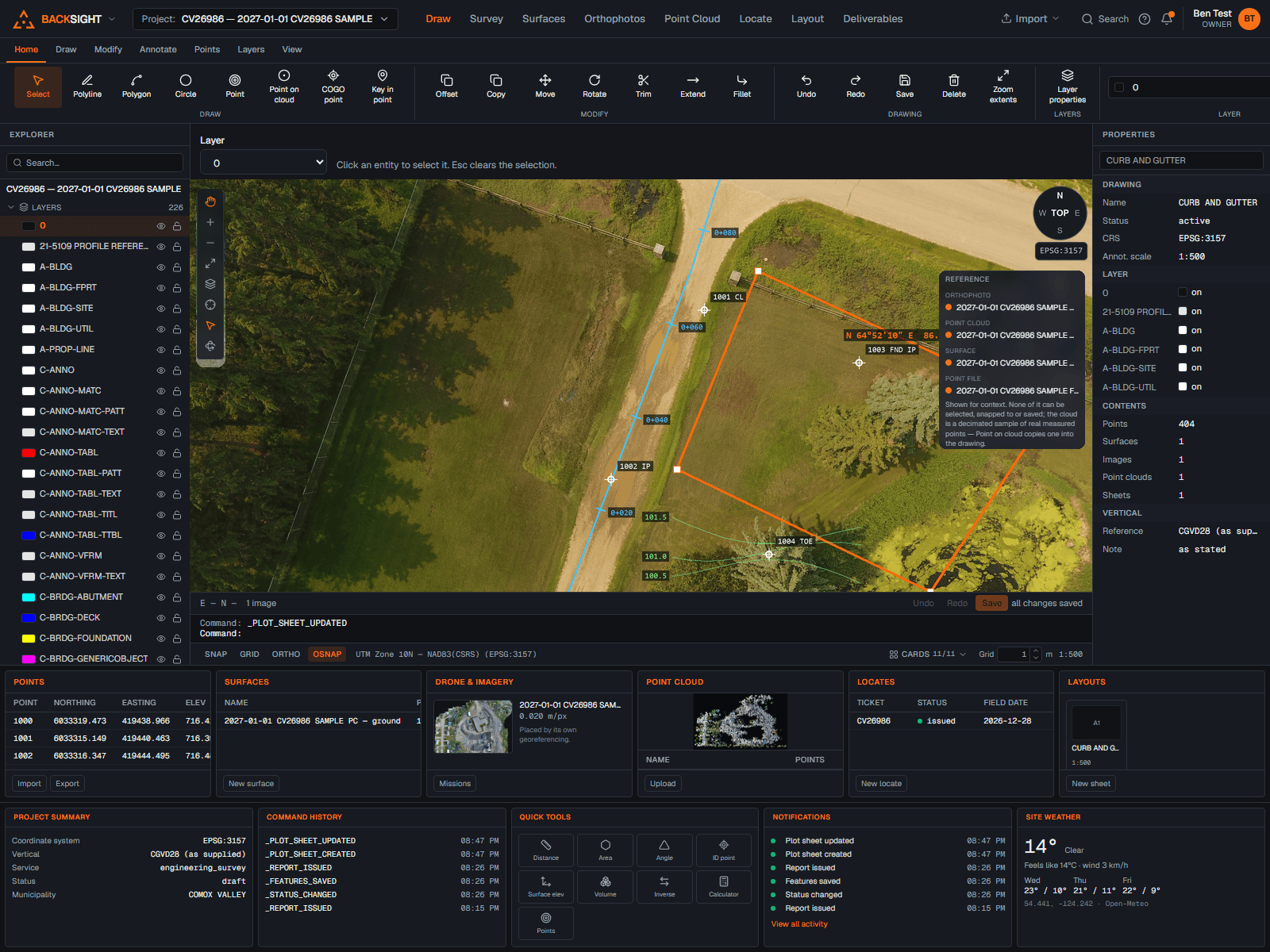
Full disclosure: this is our product, so read this section with that in mind. Backsight is survey software built in Canada, in the browser, at $99 CAD per seat per month with everything included:
- Survey CAD with a command line, snaps, blocks, linetypes and plot sheets, drafting that feels like drafting.
- Points with description keys and field-to-finish figure coding, COGO, and least-squares network adjustment.
- TIN surfaces, contours, volumes, alignments, profiles and cross sections.
- Drone photogrammetry with ground control, and point clouds in LAS, LAZ, E57, PLY or XYZ, classify ground, clip, build surfaces, compare visits. Processing credits are included in the seat.
- Canadian geodetics done strictly: NAD83 Original and CSRS never silently substituted, heights only through a verified geoid model, every calculation reporting its method.
- DXF and LandXML interchange, with originals preserved.
And where it is not a fit, plainly: Backsight does not do corridor or roadway design, does not process GNSS baselines today, and does not read DWG directly, DXF and LandXML are the doors in and out. A firm whose revenue is road design should not switch. A firm whose revenue is surveys, site work, volumes, drone mapping and locates is exactly who it is for, that is the work it was built from.
The migration question
Whatever you pick, the move is less dramatic than it feels. Your point files are text. Your surfaces and alignments travel as LandXML. Your drawings travel as DXF. Run the new tool alongside the old one on a single live job, not a toy project, and judge it on the deliverable that comes out the other end. If a vendor’s trial can’t survive one real job, that is your answer about the product.
Backsight’s pricing is public and every feature named above exists today , no “coming soon” column, no call for a quote.
Civil 3D and AutoCAD are trademarks of Autodesk, Inc. Carlson, BricsCAD, Trimble Business Center and OpenRoads are trademarks of their respective owners. Backsight is not affiliated with or endorsed by any of them; product observations reflect publicly available information at the time of writing, verify current capabilities and pricing with each vendor.
Questions people ask
- Can Backsight replace Civil 3D for a survey firm?
- For survey production, points, COGO, figures, surfaces, volumes, alignments, drone and LiDAR deliverables, plot sheets, yes. For corridor and roadway design, pressure networks, or workflows built on DWG round-tripping with consultants, Civil 3D or another heavyweight remains the right tool.
- Does Backsight open Civil 3D drawings?
- Backsight exchanges DXF and LandXML, both of which Civil 3D writes. DWG itself is a closed format and Backsight does not reverse-engineer it, export DXF or LandXML from Civil 3D and everything comes across with its geometry intact.
- What does Backsight cost compared to Civil 3D?
- Backsight is $99 CAD per seat per month (or $990 per seat per year), everything included, CAD, points, surfaces, drone photogrammetry, LiDAR and locate reports. Civil 3D is sold by subscription at a few thousand dollars per seat per year at list, before any add-ons for drone or point-cloud work.