Built in Canada. Built for surveyors.

One platform for survey, design, and reality capture.

Backsight is the all-in-one platform for Canadian surveyors. From CAD and surfaces to photogrammetry, LiDAR, coordinates, utility locating and deliverables, do it all in one place.

All access. Includes 500 photos of drone reconstruction every month; $0.04 CAD per photo after that. Cancel anytime.

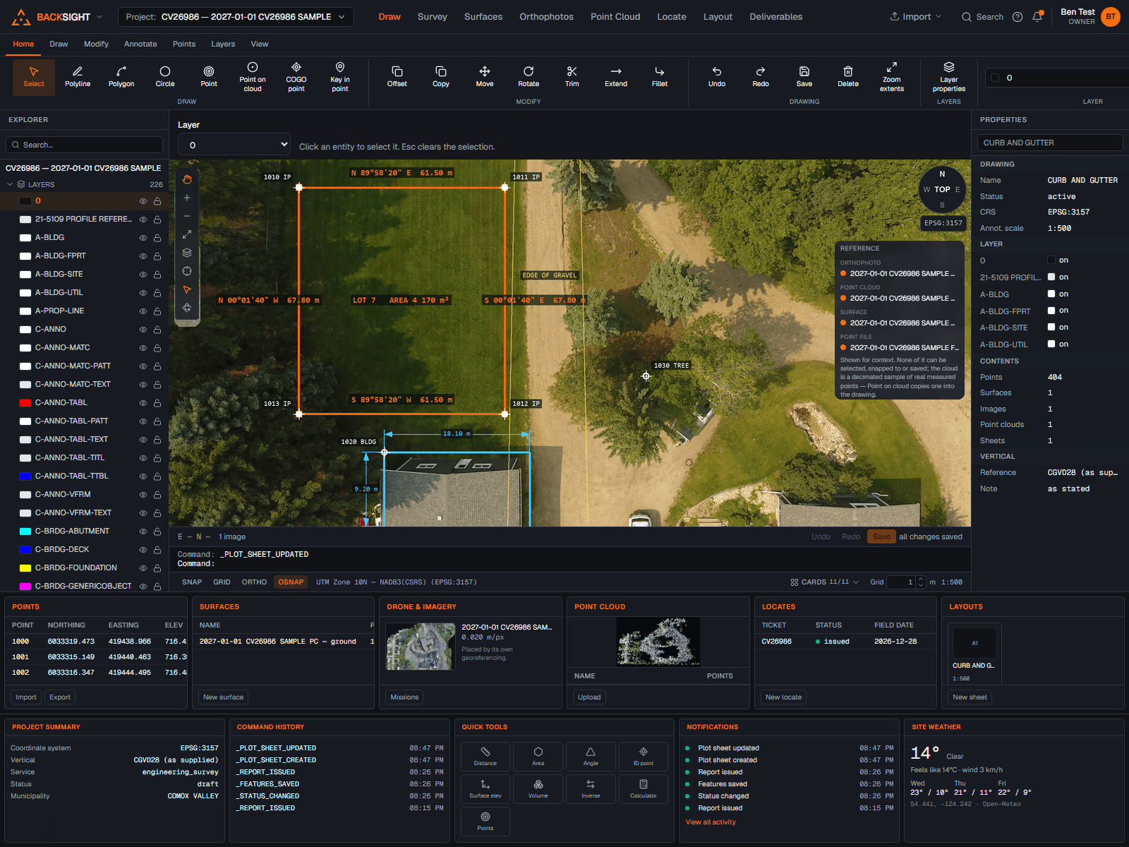
The Backsight workspace: CAD drawing canvas with ribbon, explorer, command line and status bar

CAD & COGO

Drafting and COGO tools built for surveyors, a real command line, snaps, layers, blocks and plotting. Create, edit and manage coordinates with precision.

Explore CAD

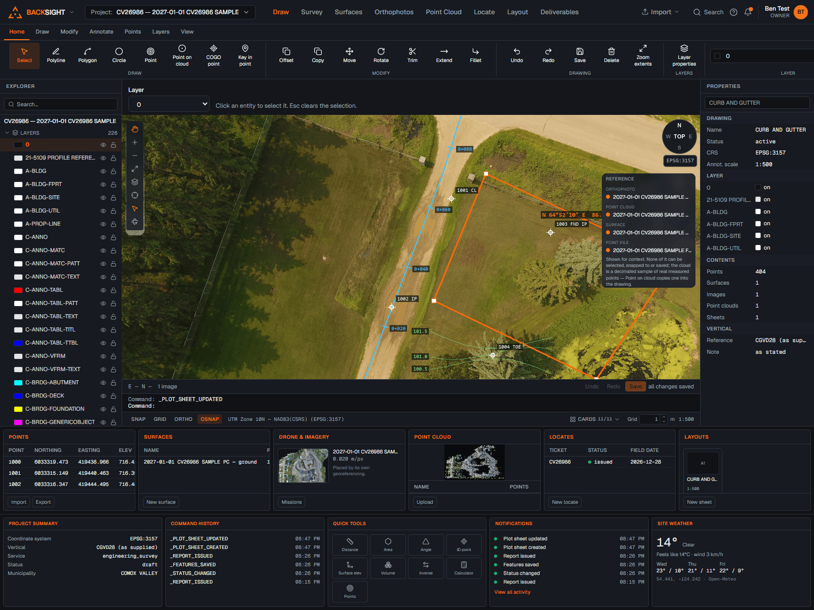
Surfaces & Volumes

Surfaces, contours and TINs with breaklines enforced, and exact prismatic volumes for earthworks, never grid approximations.

Explore Surfaces

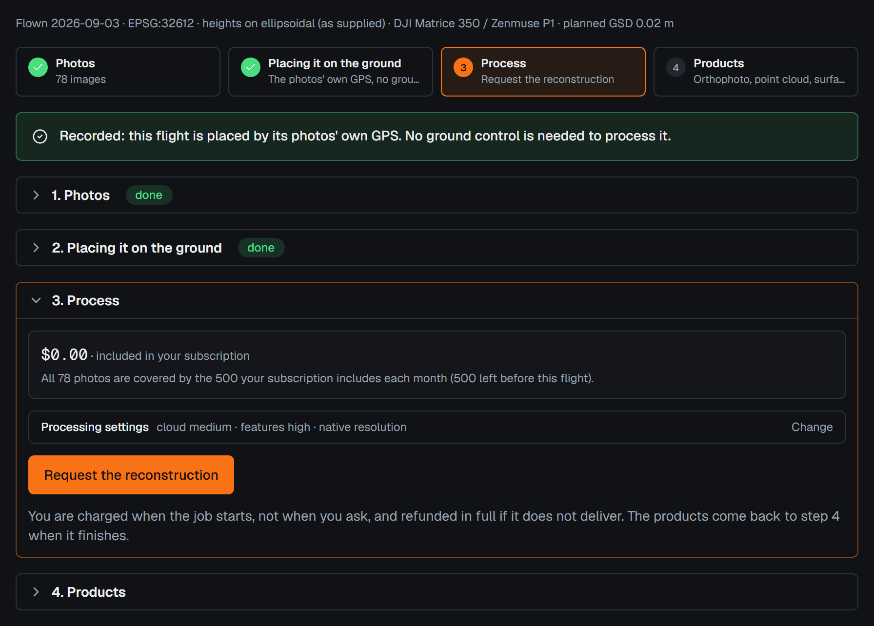
Photogrammetry

Plan drone missions, manage ground control and QC the orthophotos and clouds that come back. Processing is credit-based, pay for what you run.

Explore Capture

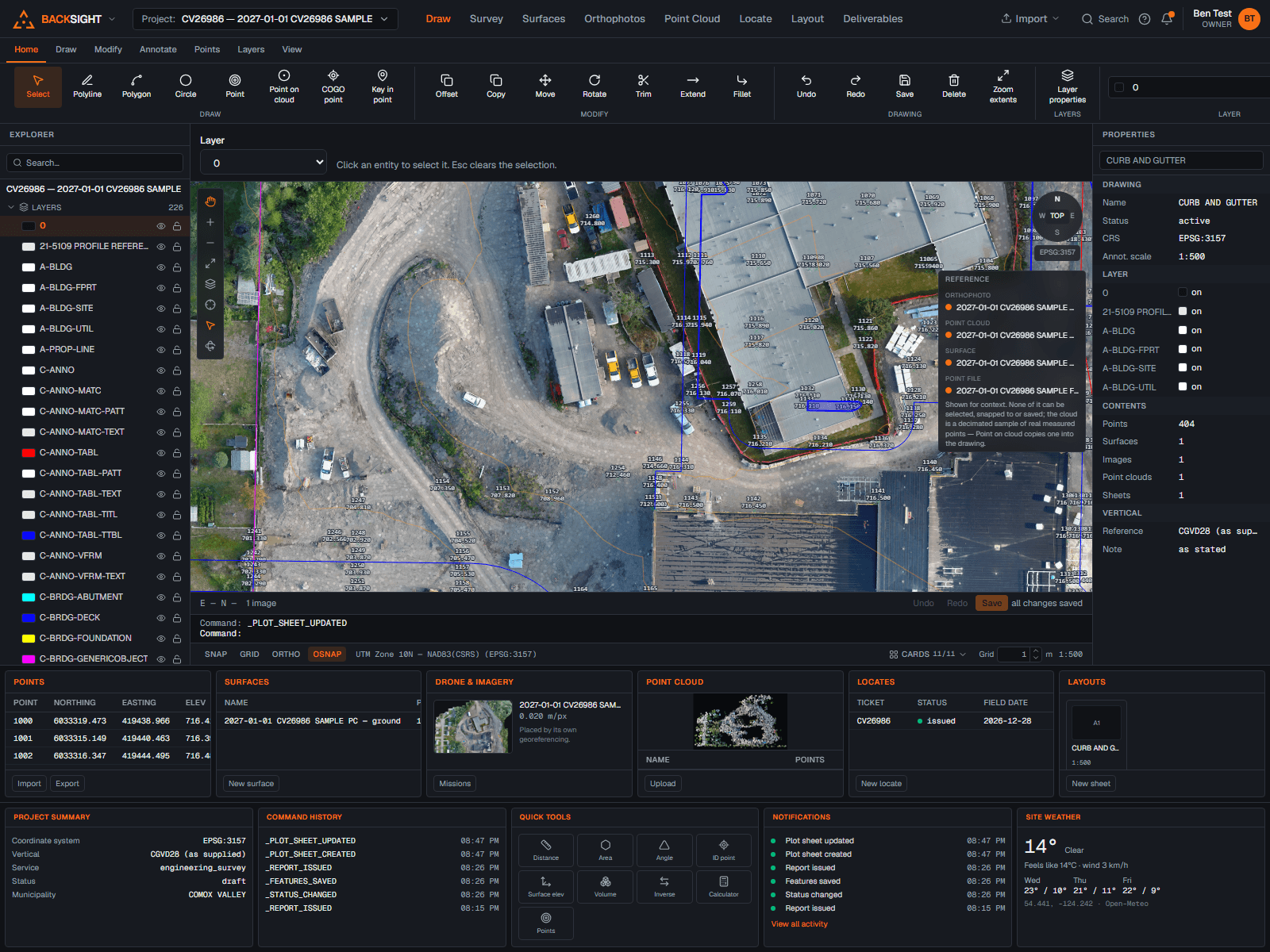
LiDAR & Point Clouds

Import point clouds, LAS, LAZ, E57, PLY, XYZ, display by classification, clip to what matters and derive ground surfaces.

Explore Point Cloud

Canadian Coordinates

NAD83 Original and NAD83(CSRS), UTM, 3TM and MTM, datums and projections handled explicitly, in the field or the office.

Explore Coordinates

Utility Locate Reports

Professional locate drawings and the traditional two-sheet report package, issued as versioned PDFs with a client portal.

Explore Locate
1
All-in-one platform

Replace a stack of separate tools with one unified workflow.

$99
Per seat, per month

Transparent pricing with no hidden costs, every seat gets everything. Yearly is $990/seat, two months free.

0
Modules to buy

Every capability is included, nothing is sold separately.

From field capture to finished deliverables. One connected workflow.

1. Capture

Bring in data from drones, LiDAR and point files.

2. Process

Process imagery and clouds. Clean, classify and georeference.

3. Draft & Design

Draft in CAD, build surfaces and volumes, analyze your data.

4. Locate & Verify

Create locate drawings, verify utilities, prepare for the field.

5. Deliver

Produce professional plans, reports and deliverables.

Everything included

Simple, all-in pricing.

Everything you need. One price per seat.

$99CAD / seat / month

All features. All modules. Unlimited projects. Or $990/seat/year, two months free.

  • CAD, surfaces, volumes
  • Photogrammetry & point clouds: 500 photos of processing included monthly
  • Canadian coordinates & datums
  • Utility locate reports & layouts
  • Support from people who survey

Month to month. Cancel anytime.

Built the way a surveyor works.

Geodesy done properly. NAD83 Original and NAD83(CSRS) are separate, deliberate selections. Heights convert through the geoid model you chose. Every calculation reports its operation, its accuracy and a reproducibility id, so any number can be traced back.

Exact numbers. Volumes are exact prismatic on the triangulation itself, no cell size to second-guess. Contours are the true intersection of the surface with level planes. Every result states the method behind it.

Records that hold up. Original imports kept byte for byte, issued reports immutable and checksummed, and a full audit trail behind everything your organization does.

Canadian company
Database and files stored in Canada
Real surveyor support
Row-level security on every table

Questions surveyors ask.

What is Backsight?

Backsight is Canadian survey software that runs in the browser: CAD drafting with a command line, survey point management, TIN surfaces with exact prismatic volumes, alignments and profiles, drone photogrammetry, LiDAR point clouds and utility locate reports, one product, one subscription.

Do I need to install anything?

No. Backsight runs in any modern browser on Windows or Mac, the office workstation and the truck laptop open the same live project. There is no licence server and nothing to patch.

What file formats does Backsight read and write?

In: DXF, LandXML, CSV and delimited point files, GeoTIFF orthophotos, and point clouds in LAS, LAZ, E57, PLY and XYZ/PTS. Out: DXF, LandXML, CSV point files and plotted PDF sheets. Originals are preserved byte for byte.

How does Backsight handle Canadian coordinate systems?

Explicitly. NAD83 Original and NAD83(CSRS) are separate, deliberate selections, never silently substituted. UTM, 3TM and MTM zones are built in, heights convert through the geoid model you choose, and every calculation reports its operation, accuracy and a reproducibility id.

How much does Backsight cost?

$99 CAD per seat per month, everything included: CAD, surfaces and volumes, drone and LiDAR, coordinates and locate reports. Pay yearly at $990 per seat and get two months free. Every seat is the same all-access plan; cancel anytime. Drone photogrammetry processing is included for 500 photos a month; after that it is $0.04 CAD per photo, quoted before every job.

Where is my data stored, and who owns it?

It is yours. The database and file storage are in Canada. Drone photo reconstruction runs on a machine rented for that one job, currently in the United States; the photos are on it only while the job runs, it is destroyed when the job ends, and the products come back to storage in Canada. Original files are kept unmodified, every edit is audited, and you can export your drawings, points and surfaces as DXF, LandXML and CSV at any time.

Can Backsight produce utility locate reports?

Yes, APWA-coloured locate sketching with photos and details, issued as the traditional two-sheet report package: versioned, checksummed PDFs with a client portal link. Issued reports are immutable records.

How does Backsight work for a team?

Everyone signs in as themselves and works in the same live projects, no file passing, no sync. Each person is a seat on the one all-access plan, roles like administrator or surveyor control what they can do, and the audit trail records who did what. Adding or removing a teammate adjusts the next invoice automatically.

Work smarter. Deliver more.

Put the whole workflow in one app on your next job.