

CAD software for surveyors: what actually matters, and the options in 2026
· 10 min read · by the Backsight team
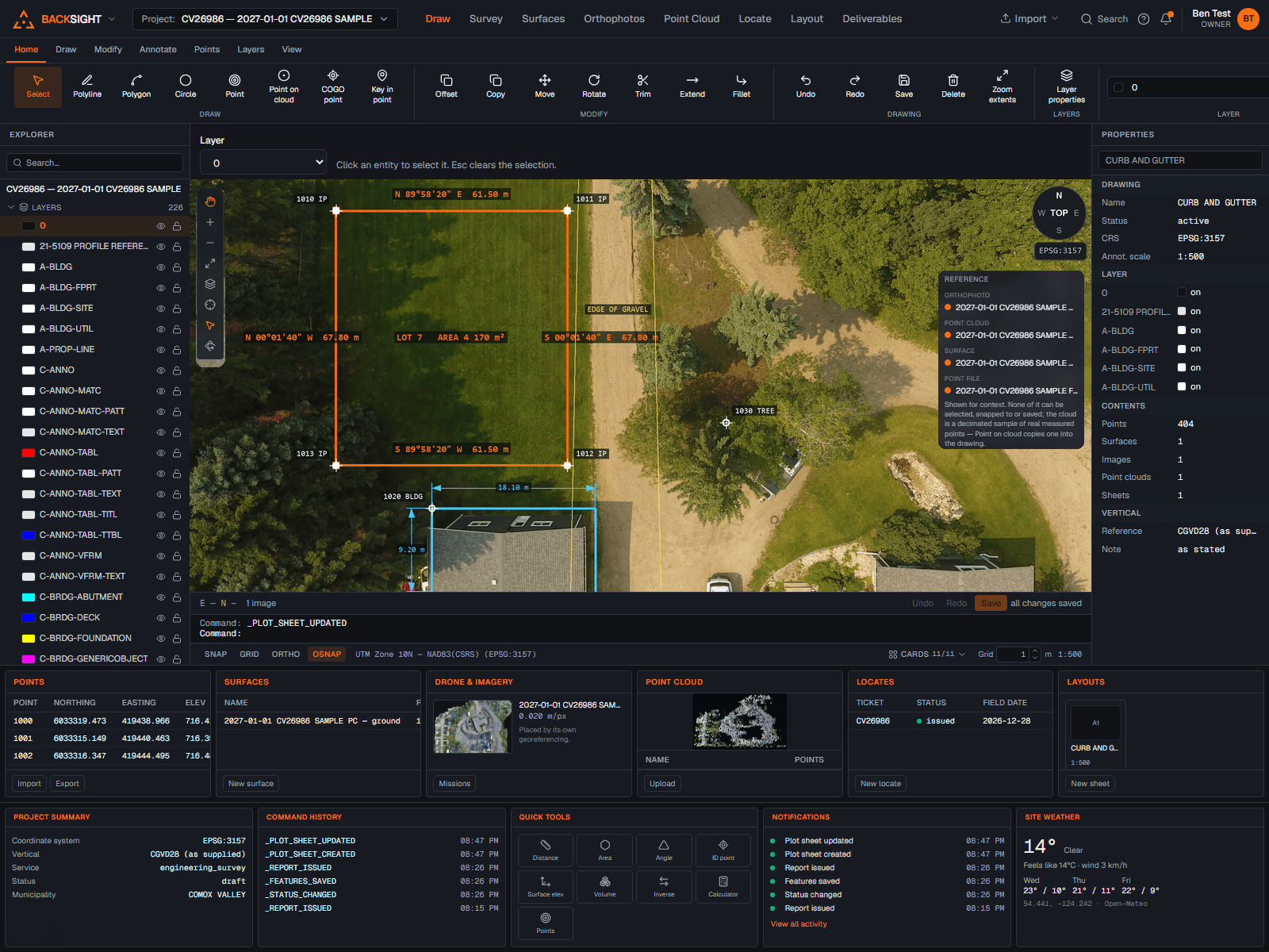
Every surveyor has drafted in general-purpose CAD at some point, and every one of them has hit the same wall: it draws lines beautifully and knows nothing about survey. No point numbers. No descriptions that become symbols and linework on their own. No idea what a bearing is, what a surface is, or that the drawing sits on a specific datum and zone. You end up buying the survey brain as a separate add-on, a separate program, or a spreadsheet full of macros somebody wrote in 2009.
This is a guide to what survey CAD actually needs to do, how to test a candidate before you pay for it, and the real options on the market — including ours, with the bias stated where it applies.
What makes CAD “survey CAD”
Six things separate survey CAD from drafting software. A product missing any of them will cost you the difference in hours, every week.
- Points are first-class. A survey point has a number, a northing, an easting, an elevation and a description — and it stays a point after import, not a block with text near it. You need to import thousands at once, edit descriptions in bulk, and export the same file your instrument reads.
- Description keys and field-to-finish. A shot coded CL lands on the centreline layer with the centreline symbol; TOE starts a toe-of-slope figure that connects to the next TOE; BC and EC turn three shots into an arc. Without this, the crew’s coding is wasted and drafting starts from scratch.
- COGO. Inverse, forward, bearing-bearing and bearing-distance intersections, traverse with closure and adjustment — typed as bearings and distances, not clicked as pixels.
- Surfaces and volumes. A TIN from your points, breaklines honoured, contours generated, volumes to a datum or between two surfaces with the method stated.
- Real coordinate systems. The drawing knows its datum and zone. In Canada that means treating NAD83 Original and NAD83(CSRS) as different things, and never converting a height without a geoid model that is actually installed.
- Survey plotting. Title blocks, north arrow, scale bar, coordinate ticks on the frame, and a legend — at a stated scale that is honoured, not fitted.
How to test one before you buy
Trials are designed to look good on a sample project. Run yours on a real job instead — a small one you have already delivered — and check these on the way through:
- Import a real point file. Your actual CSV with your actual codes. Did the figures draw themselves? Did the symbols land on the right layers? Count what got dropped.
- Type ten commands. Offset, trim, fillet, a line by bearing and distance, a point by station and offset. Do they take typed values, or only clicks?
- Round-trip a DXF and a LandXML. Export, open elsewhere, re-import. Layers, arcs, text and surfaces should come back whole — and the software should tell you if anything did not.
- Build a surface and run a volume. Then ask how the number was computed. If the answer is vague, the number is too.
- Set the coordinate system wrong on purpose. Then import points from the right one. Good software refuses or warns; bad software silently accepts, and you find out from the client.
- Plot a sheet at 1:500. Measure something on the PDF with a scale rule. It should be exact.
The options
Autodesk Civil 3D
The industry standard and the most complete civil design platform there is — corridors, pipe networks, grading, and survey tools underneath all of it, in native DWG. Its weight is also its cost: subscription pricing in the thousands per seat per year, a steep learning curve, and a great deal you will never open if your work is surveying rather than road design. We wrote a separate honest look at Civil 3D alternatives.
Carlson Survey
The long-standing survey-first answer: field-to-finish, COGO and surfaces at its core, running on IntelliCAD or on top of AutoCAD, still available as a perpetual licence. Windows desktop, an interface that has been around a while, and drone or point-cloud work handled by separate Carlson products.
MicroSurvey CAD
Built in British Columbia, now part of Hexagon, and one of the few packages designed around the surveyor’s day rather than the engineer’s. Strong COGO, field-to-finish and least-squares, on an IntelliCAD base. Desktop-only, and the broader modelling and imagery side is not its focus.
BricsCAD with survey add-ons
A DWG-native CAD engine at a fraction of AutoCAD’s price, with perpetual licensing, that runs most LISP routines unchanged. It is not survey CAD on its own — you add a third-party survey application on top — but for a firm whose real requirement is “our DWG workflow, cheaper,” it is a serious option.
Backsight — ours, so read accordingly
Backsight is survey software built in Canada, in the browser, at $99 CAD per seat per month with everything included. Against the six things above:
- Points with description keys and field-to-finish figure coding; bulk editing; source files preserved with checksums.
- A command line with typed values, snaps, blocks, linetypes, annotation, and the full COGO set including least-squares network adjustment.
- TIN surfaces with breaklines, contours, volumes that state their method, alignments, profiles and cross sections.
- Coordinate systems handled strictly: NAD83 Original and CSRS never substituted, epochs never assumed, heights only through a verified geoid model, every calculation reporting its method.
- Plot sheets that honour their scale, with fourteen sheet faces and your own title block.
- Beyond CAD, in the same seat: drone photogrammetry, LiDAR and point clouds (LAS, LAZ, E57, PLY, XYZ), and utility locate reports with a client portal.
Where it is not the answer: corridor and roadway design, GNSS baseline processing, and direct DWG — Backsight exchanges DXF and LandXML rather than reverse-engineering a closed format. If your drafting is a road-design pipeline, look at the first two names on this list.
Desktop or browser, perpetual or subscription
Desktop software runs offline and keeps your files on your machine; browser software runs anywhere, updates itself, and keeps every seat on the same version. Perpetual licences cost more up front and stop costing; subscriptions cost less to start and never stop. None of these is right in general. A one-person firm with a good laptop and no field connectivity reasonably prefers desktop and perpetual. A five-seat firm tired of version drift and IT reasonably prefers the browser. Decide on your situation, not on the vendor’s argument.
The test that matters
Whatever you shortlist, put it on one live job and judge the deliverable that comes out — the plan, the point export, the volume. That is the only benchmark a client will ever run on you. Backsight’s survey CAD is described in full on its feature page, and the price is public.
Civil 3D and AutoCAD are trademarks of Autodesk, Inc. Carlson, MicroSurvey, BricsCAD and IntelliCAD are trademarks of their respective owners. Backsight is not affiliated with or endorsed by any of them; product observations reflect publicly available information at the time of writing — verify current capabilities and pricing with each vendor.
Questions people ask
- Is AutoCAD enough for surveying?
- For drafting, yes; for surveying, no. Plain AutoCAD has no survey points, description keys, field-to-finish, COGO, surfaces or coordinate-system awareness, every one of those has to come from an add-on or a separate product. Survey CAD is what you get when those are built in.
- What CAD software do land surveyors use?
- Most commonly Autodesk Civil 3D and Carlson Survey, with MicroSurvey CAD popular in Canada and BricsCAD-based setups where DWG compatibility at a lower price is the priority. Backsight is a newer browser-based option at $99 CAD per seat per month that includes drone, LiDAR and locate reporting in the same seat.
- Is there survey CAD that runs in a browser?
- Yes. Backsight runs entirely in the browser, command line, snaps, blocks, COGO, surfaces, alignments and plot sheets, with nothing to install and every seat on the same version. Desktop packages such as Civil 3D, Carlson and MicroSurvey are Windows applications.
- How should I evaluate survey CAD before buying?
- Put it on one real job you have already delivered: import your actual point file with your codes, type ten drafting commands, round-trip a DXF and a LandXML, build a surface and run a volume, deliberately set the wrong coordinate system to see whether it warns, and plot a sheet at a stated scale and measure it.