
Orthophotos and background imagery
Bring a georeferenced image in, place it under the drawing, clip it and drape it.
4 min read
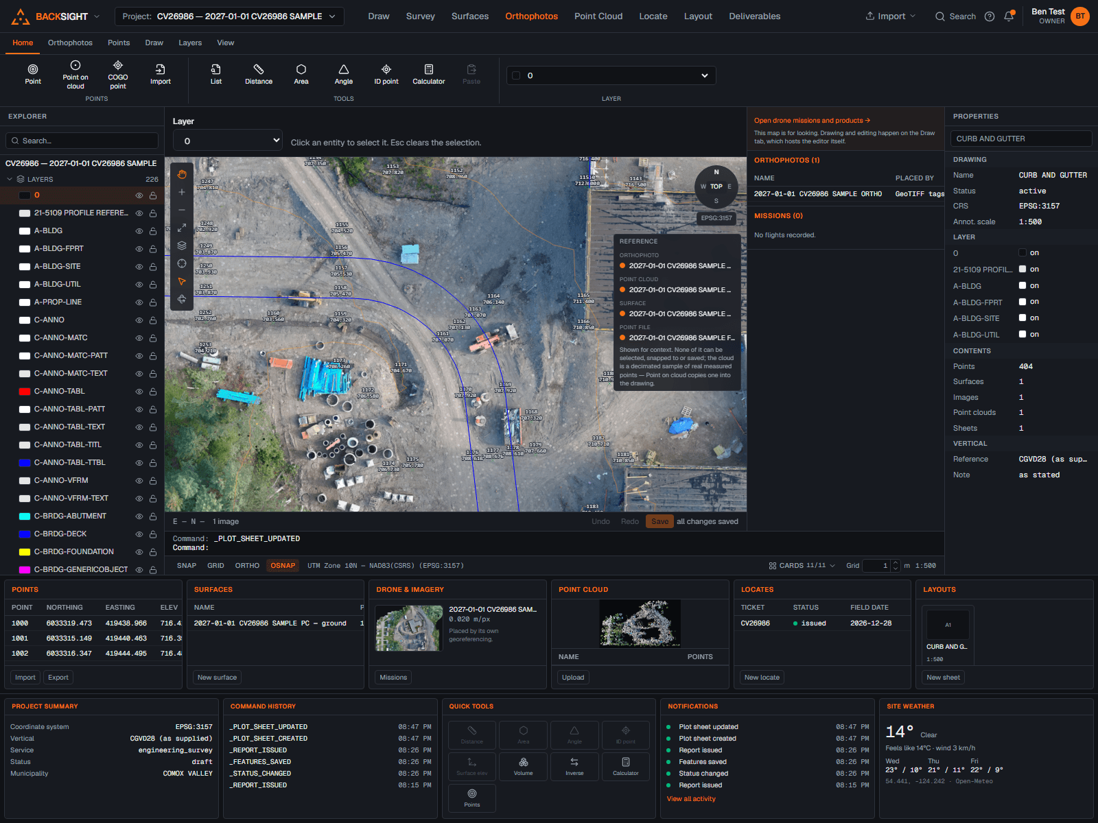
Bringing an image in
- Import (top bar, any mode) → Orthophoto, the drawing's Imagery panel opens on the form.
- Upload a GeoTIFF, or an image with a world file beside it.
- Confirm the coordinate system it is on, Backsight reports what the file declares but never adopts it silently.
- It appears under the drawing at its real extent.
Working with it
- Opacity, so linework stays readable over it.
- Visibility, hidden images do not plot.
- Clip to a polyline, non-destructive, so the original file is untouched and the clip is reversible.
- Drape over a surface, to see the ground and the terrain together.
- Draw order, images order among themselves in the Imagery panel, sit beneath the linework by default, and a per-image switch lifts one over it. A Google or OpenStreetMap backdrop always stays at the very back, under imagery and points both.
Note
Visible imagery is embedded in the plotted PDF as bytes, so a sheet is a self-contained document rather than one that depends on a link still working.
Zooming in on a large orthophoto
A drone orthophoto is routinely 15,000 px or more across. The canvas keeps a display copy capped at 4096 px for the whole-site view, and for anything larger it also keeps a tile pyramid: the image cut into 512 px squares at every zoom level, down to the image's own resolution. Zoomed out, a handful of tiles load; zoomed in, only the sharp ones under the view do, so a large ortho is crisp at 2 cm a pixel without the browser ever downloading the whole thing.
- GeoTIFFs larger than the display copy are tiled on import. The Imagery panel marks them “tiled”.
- An image placed before tiles existed shows a “sharpen” link instead: it rebuilds the pyramid from the stored original. Nothing about the placement changes.
- The pyramid reaches the file's full resolution. A large ortho is read a band of rows at a time straight from the file's own tiles, it never has to be decoded whole, so a 250-megapixel GeoTIFF tiles in a few minutes. Only an unusual layout (16-bit, planar, or a compression outside the common set) stops short at the file's largest overview, and the import says so; the original always holds every pixel.
Read next
- Drone flights: from photos to productsUpload a flight, choose how it should be processed, and know what it costs before it starts.
- Sheets: setting one up and plotting itA sheet at a real scale, with a title block, a legend and your logo: then a PDF you can prove.
- Building a surfaceTriangulate points into ground you can contour, measure and stake from.
Something here wrong or missing? Tell us and we will fix it.