
Projects: what they hold and how to set one up
A project is a grid, a vertical reference and everything measured on them. Here is how to start one properly.
4 min read
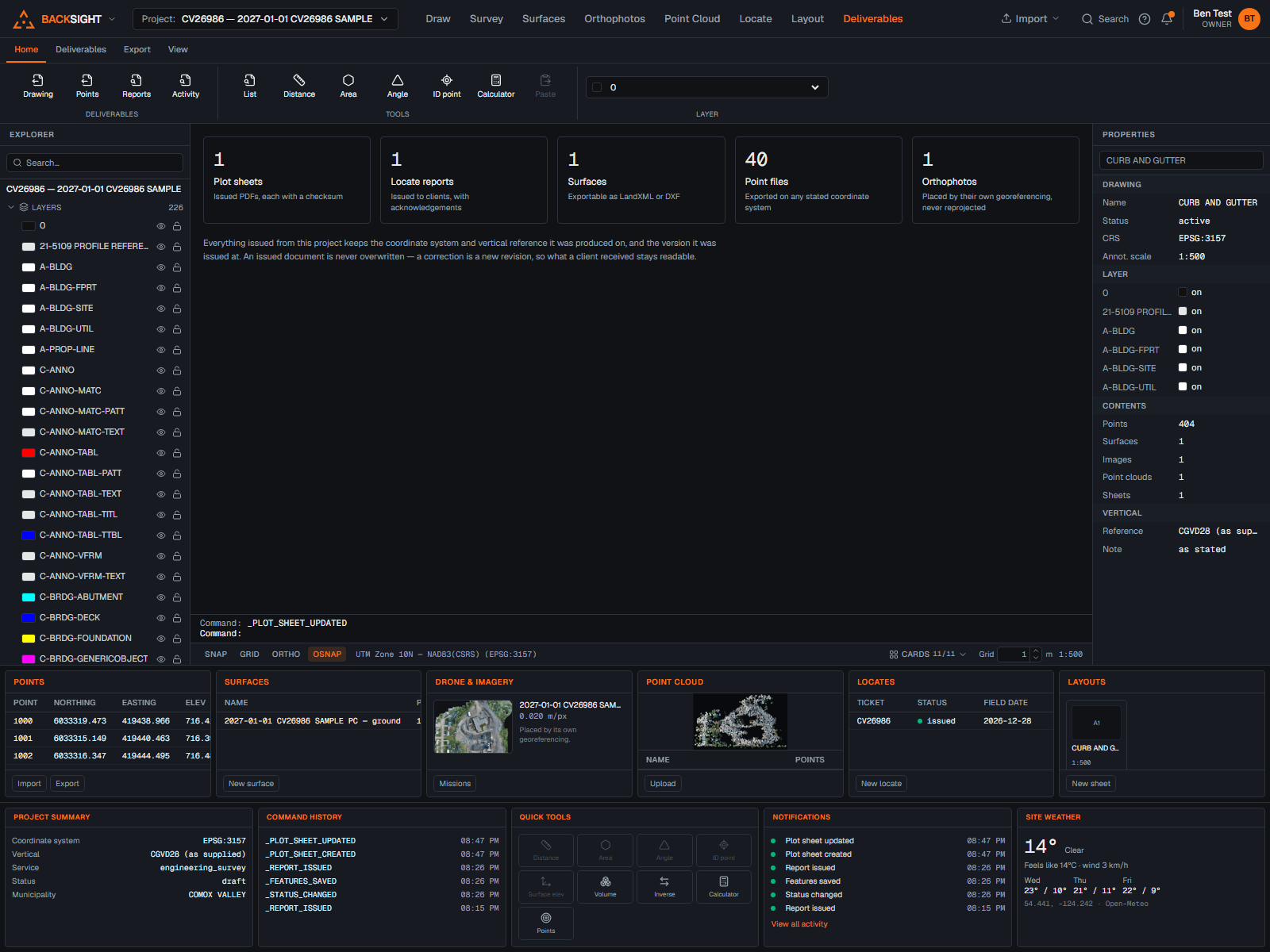
What a project is
A project is the container for one job: its coordinate system, its vertical reference, and every drawing, point, surface, image, cloud and locate measured on them. Nothing crosses between projects by accident.
Creating one
- Projects → New project.
- Name and project number. The number must be unique in your organization, if it is already taken you are told immediately, and nothing you have typed is lost.
- Client, if you track them.
- Province or territory, chosen from the list.
- Coordinate system: search the Canadian presets, or enter an EPSG code.
- Vertical reference: a published datum, or an assumed local datum stated plainly.
- Create.
The grid is not a detail
NAD83 Original and NAD83(CSRS) are different systems and Backsight treats them as different selections. Getting this wrong moves a survey by an amount that looks plausible. If you are not certain, ask the client which one their control is on.
Changing settings later
Project → Coordinate settings holds the grid, the vertical reference, the geoid model and the units. Changing a setting does not silently reproject anything already measured; Backsight tells you what a change means before you commit it.
The settings page also gives you:
- Dropdowns for everything that has a known list, so there is nothing to mistype.
- A check that reads your settings and tells you whether they hang together, with a one-click fix where there is an obvious one.
- Warnings when a combination is unusual rather than wrong, with the reason.
Deleting a project
An owner or administrator can delete a project from its Overview page. Before the button becomes active the page lists what will go, drawings, points, locates, files, and you have to type the project's name.
There is no undo, no trash and no export-first step
Drawings, points, surfaces, point clouds, orthophotos and every uploaded file go for good. Download anything you still need before deleting.
Issued locate reports are kept
An issued report is a record, it went to a client, and somebody may have dug against it. Deleting the project does not remove it. Issued reports stay under “Issued reports”, each showing the job number and address it was issued under, and any link already sent to a client keeps working. The locate itself, its photos and its sketch go with the project; the issued document does not.
Uploads that never finished, a dropped connection, a large file that failed part way, belong to nothing and cannot be reached. “Reclaim unfinished uploads”, on the same page, removes those and leaves everything else alone, so it is safe to run while somebody is still uploading.
Read next
- Choosing a coordinate systemThe one decision everything else rests on, and how to be sure you have it right.
- Quick start: your first drawing in ten minutesFrom a new account to points on a drawing, a surface, and a plotted PDF, the short version.
- Your team, roles and organization brandingInvite people, decide what they can do, and put your logo and colours on everything you issue.
Something here wrong or missing? Tell us and we will fix it.